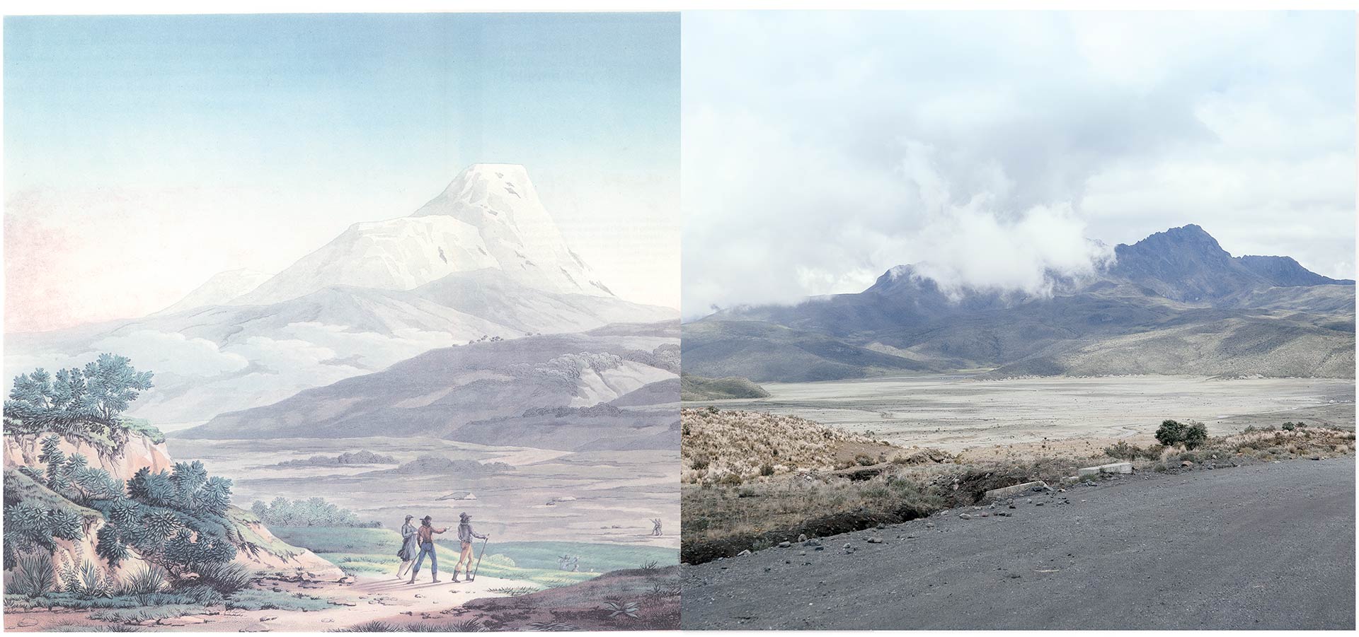
Volcán Cayambe | collage | 60 x 30 cm
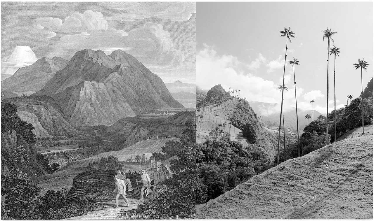
Besides texts, objects and measurements Alexander von Humboldt featured maps and graphic images as a principal mode of describing and portraying Latin America. He created a famous series of color plates depicting natural and cultural micro-environments. These images are science and art at the same time - hybrids that combine visual layers with collected data and complex information about very specific locations, about the landscape, the indigenous inhabitants and their culture. The locations shown served as a starting point for a series of collages, combining the graphics from Humboldt’s book “Views of the Cordilleras and Monuments of the Indigenous Peoples of the Americas” with my photographs from the exact same places in Colombia, Ecuador and Peru.
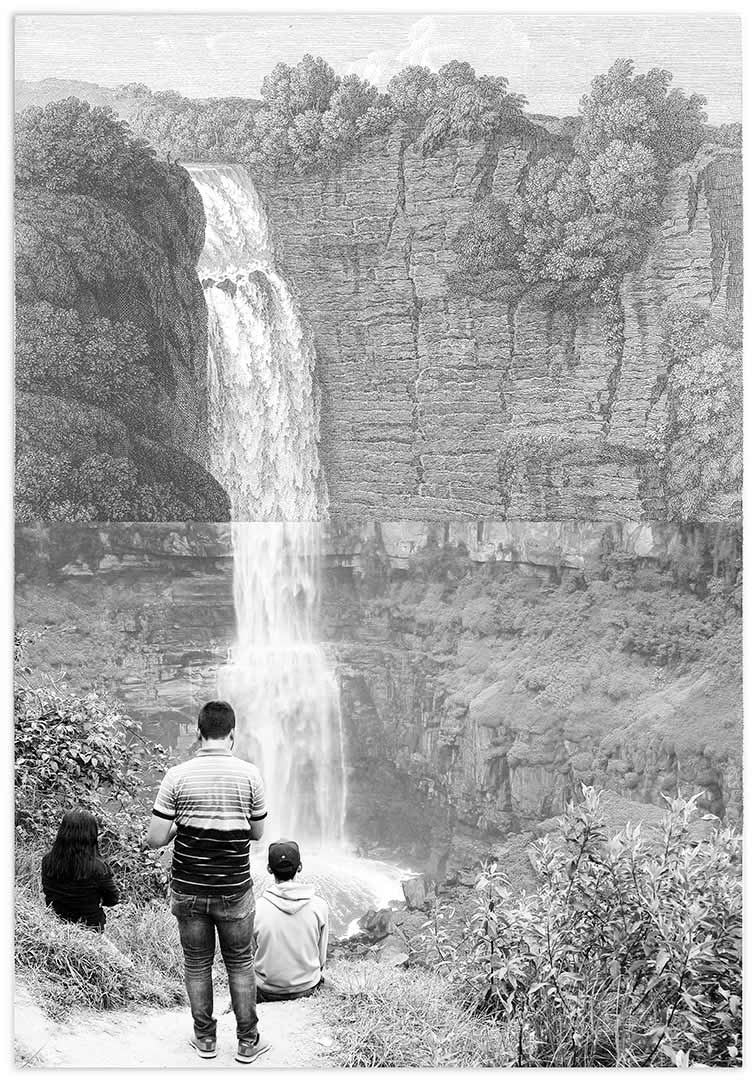
Salto del Tequendama | collage | 27 x 20 cm

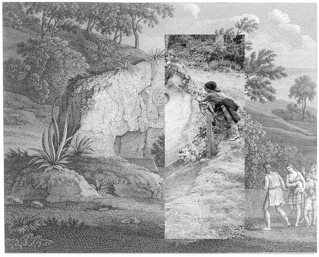
Ruins of Ingapirca | collage | 30 x 21 cm
Mud volcanoes of Turbaco | collage | 30 x 21 cm
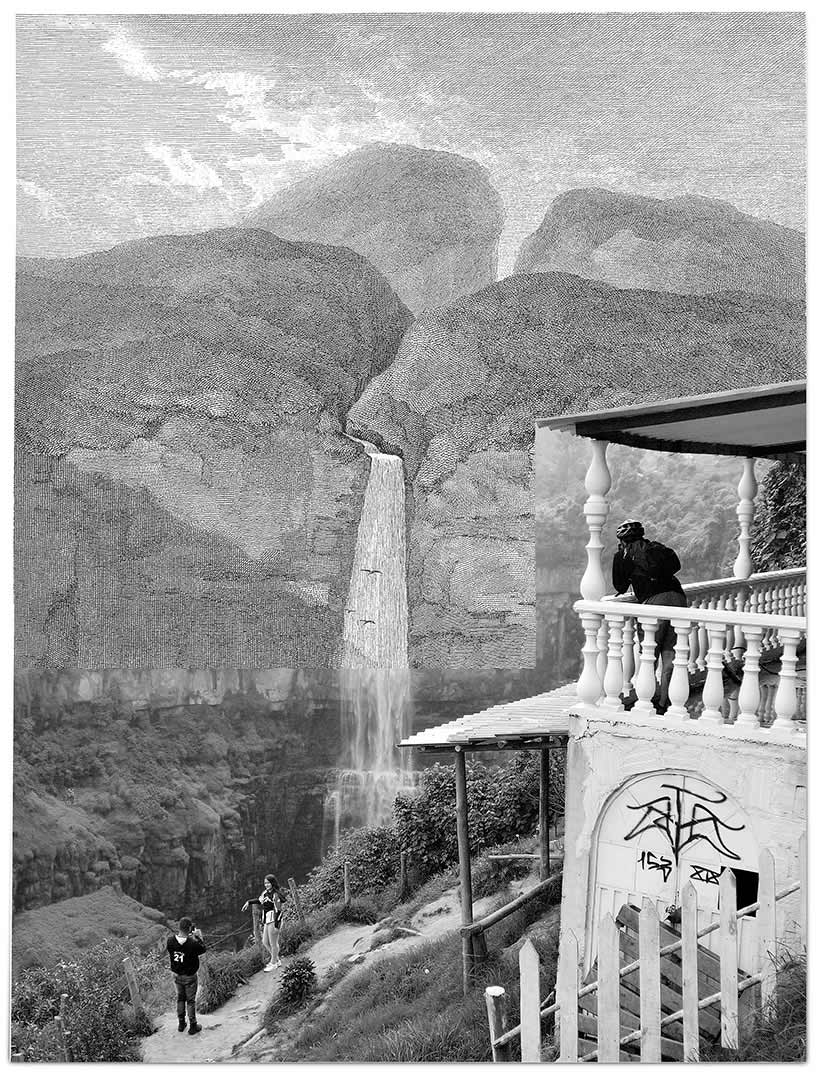
Rio Vinagre | collage | 26 x 19 cm
Quindío Passage | collage | 48 x 28 cm

Volcán Cayambe | collage | 60 x 30 cm
Besides texts, objects and measurements Alexander von Humboldt featured maps and graphic images as a principal mode of describing and portraying Latin America. He created a famous series of color plates depicting natural and cultural micro-environments. These images are science and art at the same time - hybrids that combine visual layers with collected data and complex information about very specific locations, about the landscape, the indigenous inhabitants and their culture. The locations shown served as a starting point for a series of collages, combining the graphics from Humboldt’s book “Views of the Cordilleras and Monuments of the Indigenous Peoples of the Americas” with my photographs from the exact same places in Colombia, Ecuador and Peru.

Salto del Tequendama | collage | 27 x 20 cm

Mud volcanoes of Turbaco | collage | 30 x 21 cm

Ruins of Ingapirca | collage | 30 x 21 cm

Rio Vinagre | collage | 26 x 19 cm

Quindío Passage | collage | 48 x 28 cm
